We had planned to return to the Southwest Coast Path—and had in fact reserved the entire trip—but England just didn’t want us, vaccinations or no. So, after casting about for alternatives (fighting the crowds in the northern parks, etc.), we decided to make for Iceland. We won’t walk nearly as much as we would have on the Coast Path, but we hope to pack in plenty of day hiking…including a day on a glacier.
Category: Iceland 2021
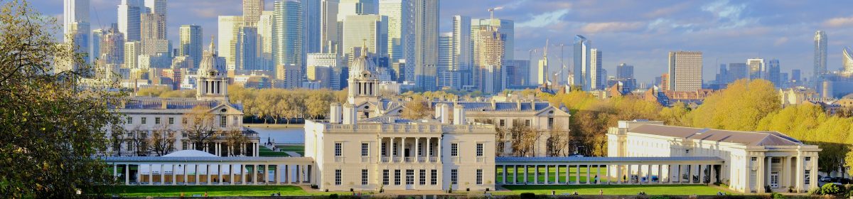
Reykjavik
Wednesday, August 21
Given the constant changes that travel brings, it is comforting that some things are totally reliable. One of the most reliable is the ability of United Airlines to deliver a devastatingly awful experience. Having booked seats across the aisle from one another, we discovered at the airport that we had been separated and placed at opposite ends of the last row of the plane: seats that don’t recline, seats right next to the washrooms. With my sleep superpower I still got in a couple of hours, but Sue only dozed on and off.
Things picked up immediately on landing in Reykjavik. I had been through the airport 51 years ago (gulp) with Paul Chandler on our way to Europe, back when Icelandair had the formal name Icelandic and the well-earned nickname Hippy Airlines. I still remember feeling the ribs of the seat back as I tried to recline. And Sue, on her first trip to Europe in 1976, had bought me an Icelandic sweater that I had for more than 30 years. Our memory of the terminal, perhaps distorted, is of a kind of large shed with piles of sweaters. Today’s airport is modern and, if a bit generic, rather attractive. It also included a wonderful advertisement for one of Iceland’s great treasures: its water! The best we’ve ever tasted…take that, you provincialNew Yorkers!

Our vaccination certificates were barely examined, and we were soon on a bus into Reykjavik.
After a bit of extra hiking as we searched for our hotel, and finding, of course, that no rooms were ready at 9:30 AM, we set out to have a look around. After a coffee and pastry at a wonderful bakery, we walked down Laugavegur, the main shopping street. This picture gives a very good sense of visiting Reykjavik at the (hopefully) tail end of the pandemic.

The capital feels very much like a provincial small town: relaxed, unfussy, unhurried. The effect is clearly enhanced by the pandemic: almost two million tourists visited Iceland in 2019; so far this year, the number is 75,000.
The downtown area is compact and it didn’t take us long to have a look. The nicest parts of town are the area around the City Hall and Parliament Square. The contrast between the City Hall and Parliament Square is remarkable: on the square, the neoclassical Reykjavik Cathedral dates from the eighteenth century and the Parliament dates from the mid-nineteenth century. Both are charmingly modest by almost any measure. We were still pretty knackered from lack of sleep, so we sat in some very comfortable chairs on the lawn and did some people watching. A group of young people in front of us took advantage of the bright sunshine and did some sunbathing…in 63 degree weather!


The City Hall screams out century twenty one; but in a good way.

The City Hall sits at the edge of a lovely lake with views across to the University of Iceland (founded only in 1911) and the city airport. And it contains a cool relief model of the whole country. That’s the Westfjords you’re looking at: one of our goals for our next trip.

For reasons I don’t fully understand, there is a statue of a Princeton University administrator at the edge of the lake.

We then walked down to the seashore. The new Reykjavik concert hall, called the Harpa, sits right on the water.

Nature is never far away, even in Reykjavik. The harbor has views across to tow after row of mountains.

We have no idea of real estate prices here, but these waterfront apartments can’t be cheap.

One last thing on the shore:

After a very restorative siesta, we walked up to Reykavik’s highest point and perhaps its best know landmark, the Hallgrimmskirkja. Designed by Iceland’s most famous architect, Guðjón Samúelsson (who also designed about half the major buildings in Reykjavik), it was started in 1945 but only completed in the 1980’s.

The inspiration for the church is supposedly one of the great waterfalls on the East Coast: what appear to be supporting pillars on each side of the tower represent the basalt columns found alongside the waterfall.
The church is visible from everywhere in central Reykjavik.

We continued our private Samúelsson festival by having a drink at another building he designed, the Apotek Hotel, an Art Deco addition to the center of town.

We had an excellent dinner at The Fish Market. Note that this photo was taken at about 8:30 PM. Sue had terrific sashimi and I had an excellent piece of cod.

We finished the evening with a walk to the Old Harbor, full of yachts, boats for whale viewing, and the odd Icelandic warship.

The Golden Circle
Thursday, July 22
A quick taxi ride—with a shorter, stockier spitting image of Rory W.—brought us to the city airport and our car for the trip, a little Suzuki SUV with four-wheel drive (required in Iceland on all unpaved roads). We were soon out of Reykjavik and rolling toward the interior.
The landscape along the coast looks very much like the Scottish heath, with mottled yellows, browns, and greens—and absolutely no trees. As we soon learned, the major difference consists in the fact that this stuff is growing on a lava field.

We soon began to rise into higher country, with more green (though no more trees). After a half hour or so, we climbed up to a high mountain pass and extraordinary scenery. That’s our little chariot, ready for what comes.

Unfortunately, the photos are going to give a rather pale idea of the landscape: it rained all day! But you do begin to get an idea of the remarkable nature of the rock formations.

The road descended sharply onto the shores of Thingvellatn, the largest natural lake in Iceland. Huge, and ringed with mountains, the lake is the centerpiece of a national park.

Circumnavigating the lake brought us to a place sacred to Icelanders, Thingvellir. This area at the northern end of the lake is revered as the birthplace of the Icelandic nation. It is of real historical interest, but the geological features are probably more interesting to non-Icelanders. The cliffs on the right of this picture are one side of a fissure in which the North American and European tectonic plates are both visible; you can see where the earth is slowly tearing these two formations apart—at a rate of about two centimeters a year.

The jumble of rocks on the left are part of what has fallen away, out of the fissure. The picture below shows how the fissure spread: Thingvellatn Lake is in fact just part of this huge fissure. To give you some idea of the magnitude of the fissure; the bottom of the lake is at places below sea level!

But enough geology. Starting in the eleventh century, the chieftains of the Icelandic tribes gathered here annually to settle disputes and pronounce the laws of the land. The law rock itself, from which the convener declaimed, is rather nondescript, with a walkway just below it. Here it is in all its glory, with the wall of the fissure behind it.

Here it is from the backside.

No matter where you go in Iceland, you are struck by the rushing waters, And this is no exception. The Oxara river plunges over the cliffs, ending in a lovely cascade, and then becomes a braided stream as it flows to the lake.


The drive to our next stop, Geysir, was also lovely. We caught sight of the major volcano in southwest Iceland, Hella, snow covered at over 5000 feet. Our hotel in Geysir, the eponymous Hotel Geysir, was extraordinary: Scandinavian, but with darker wood befitting the volcanic landscape. Since we could walk across the road to the geothermal area that gave the town its name later in the evening, we pushed on to Gullfoss (golden falls). Nothing prepares you for the sight of the falls as you walk across a fairly flat plateau. You are soon exposed to a deafening roar…and then an enormous gorge opens at your feet.

The gorge below the falls is remarkable in itself.

As you can probably tell, the rain was really coming down. Ask us to see Sue’s videos when we return!
After a nice dinner at the hotel, we made it to the geothermal area. The water is heated by magma under the surface, and the water reaches temperatures of 170-200 degrees; a sign cautions that it is 62 kilometers to the nearest hospital.
You encounter a number of hot pots first.
And then a baby geyser that only bubbles along. And finally Stokkur, the one active geyser in the area; it goes off every 5-10 minutes.

Pretty neat.
Kerlingarfjöll Mountains
Friday, July 23
As the bard said, “there’s no success like failure”…and we failed successfully today. Our goal was to drive deep into the Icelandic highlands in our little 4WD vehicle, traversing more than 40 miles of rutted, rocky, potholed dirt road, arriving at the Kerlingarfjöll Mountain Resort in order to hike to and around the Hveradalir geothermal area, set amid amazingly colorful rhyolite mountains. That was our goal. Just to whet your appetite, here’s a picture taken by someone else of the geothermal area.

We woke to rain, harder than yesterday, and set out after breakfast hoping for the best. The road runs northeast for about 25 miles before turning to dirt. The first miles on the dirt road are green, with blue lupine covering the hills. And the road itself wasn’t so bad: lots of washboarding, so that we were shaken and stirred, but doable.

But the landscape soon turns into something that can only be described as lunar.

Barren, trackless, and desolate for miles around, this part of the interior has a feeling of total remoteness. The land is littered with huge boulders, some as big as houses, erratics left behind as the nearby glaciers receded. Even in the rain, the barren vistas seemed to stretch out to infinity, broken only by distant glaciers, mountains, and volcanos. We were awestruck and, yes, a little on edge.
A bit further along, just as the road turned truly awful, the first large mountain range loomed up on our right.

After we crossed the end of an enormous lake, we began to get views into the multi-hued mountains around Kerlingarfjöll.

In the foreground is a braided river; we’ve already seen a number of these flowing down from glaciers. The colored hills behind them are covered with rhyolite, a type of lava that is particularly susceptible to being worked by mineral effects produced in geothermal areas.
The further north we drove, the worse the road got: not just the washboarding we’d had since the beginning, but long stretches with huge rocks, deep holes, and no shoulder.
We eventually turned off the “main road” and into the Kerlingarfjöll region itself—a land of rushing waters.


After a rough but thrilling ride, we arrived at the little enclave that calls itself a mountain resort (this and any other picture you see here that shows clear skies is not ours).

After speaking with a very nice lady in the main building, we decided to drive up to the geothermal area rather than try the hike. The hike was only about three or four miles each way, but the weather seemed to be turning for the worse and there was a real danger of getting whited out on what were described as rather sketchy paths, sometimes over snow fields, before we reached our destination.
So we made what we thought was a wise decision and headed very slowly up a precipitous road that made the road into the area look like an interstate: rocks, deep gashes, total washouts slowed our way. But we made it to the high point of the road, very close to the geothermal area…and the heavens let loose like they meant it. It wasn’t finally either the torrential rain or howling wind that put us off—even Sue admitted that my gear geekery had us well prepared for the conditions—but the fact that we actually were whited out, with dense fog added to the mix. Visibility ran to perhaps 25 yards. We tried to wait it out, but things only got worse. So back down we went…a failure.
But who was going to let appalling conditions stop us from walking? When we got down to the resort, it had cleared (momentarily, as it turned out), so we suited up. The moment we stepped out of the car, though, the rain and wind let loose, with rain driven horizontally into our faces as we walked. You can see the start of the trail across the river to the left in this picture from a calmer day.

The trail ran alongside a raging river; we followed it for about a mile upstream as it climbed ever higher underneath a series of ledges.

But the water was gradually washing out the more exposed parts of the path as they traversed scree slopes above the river, so that our footing was often treacherous. So here too the intrepid explorers were turned back.
The ride back was quite a bit quicker than the ride in. The drive up to the high point above the resort had alerted me to the comparatively fine condition of the main road, and we flew along, potholes, tires, and suspension be damned.
Yes, we would have loved to spend a few hours hiking in Hveradalir. But we have no regrets. We were exposed to some of the most remarkable terrain that we’ve ever seen. And the journey was itself the adventure.
Tomorrow is another day, and we plan to head into the highlands once again….
Landmannalaugar
Saturday, July 24
We woke to…more rain. We were resolved, though, to make another foray deep into the highlands and hope for better weather.
The road drive from Geysir to Landmannalaugar (something like “countryman’s rest,” a reference to the thermal pools that have provided relaxation for the locals for many years) was amazing for its beauty and its contrasts. The first third took us through some verdant farmland amid the mountains; following the course of a huge river that often opened out into the kind of inland sea one encounters on the Hudson, we drove east toward the huge dormant volcano Hekla. Here is the church of one of the very few villages we passed.

With a height of 1500 meters, the volcano itself was shrouded in cloud.

As we came abreast of the volcano, the road rose over a high ridge and, once down on the other side, we were in a lava field that stretched for at least ten miles. The proprietor of the guesthouse where we spent the night said that the volcano last erupted in 2005, killing livestock and destorying farmland.
Much of the next section of the drive took us through country that mixed verdant fields and lava.

As we came nearer to the start of the gravel road that led about 25 km into Landsmannalaugar, the terrain become increasingly arid and lunar.
This may be the time for a note on road travel in Iceland. In the western third of the country, there is a sparse network of roads that lead from the Ring Road on the coast into the interior. These roads

And then the fun really started. The F road that led into the natural area was much worse than the road travelled yesterday. Although there were fewer large rocks and potholes, the washboarding was relentless and at times downright violent.

We thought our little Suzuki was going to be shaken to bits, but somebody bolted it together pretty well, because it came through like a champ. We heard a few cars that sounded like some parts had come loose or fallen off, but not our chariot.
The scenery was increasingly spectacular as we drove into the mountains.

Landmannalaugar is only one of a number of natural areas in a the huge Fjallabak Nature Preserve. As we entered the preserve, we chatted with a very nice ranger who gave us some tips on the area. The first one was to drive up off the main road to see a lake in a deep hollow.


Aside from the numerous bugs, we saw very little wildlife in the highlands. These guys wer the exception.

As we drew nearer to Landmannalaugar, we began to see our first rhyolite mountains.


As the photos make clear, much of the area is a huge lava field, spewed from the many volcanos in the area. Most of the lava is basalt—the black or grey stuff with which we’re all familiar. Rhyolite lave, though, is multicolored, with the various minerals it contains each producing a different color.
There are actually three gravel roads into Landmannalaugar; our choice, F 208 from the north, is the only one that doesn’t involve a river crossing. Our road came to an effective end with a parking area at the edge of a river. Larger vehicles can cross the river itself, though not everyone makes a good decision about whether their car has enough clearance.

We chose the footbridge. And, just as we got out of the car, the sun came out…and stayed out for the rest of the afternoon.

That’s the encampment in the background: a ranger station with information on the trail; a bunkhouse; a pretty rough campground (tent sites are your choice; rocky or soggy); and a couple of old trucks that serve food and drink.

One of the problems of hiking in the highlands is the time it takes to access the area: day trippers like us are limited to shorter walks. We chose a loop that gave us a taste of most of what the area has to offer. The trail rises from the encampment onto a vast lava field.

As you walk through a well-graded path through the field of black and gray basaltic lava, mountains become visible all around: the contrast between the basaltic lava and the increasingly colorful rhyolite is stunning.

As you near the end of the lava field, a huge meadow opens at your feet…with the most colorful mountains we’ve ever seen as a backdrop.


From here the trail climbed onto the shoulder of Brennisteinsalda, said to be the most colorful mountain in Iceland. The angle and brightness of the sunlight has an incredible effect on the minerals in the rhyolite.


The shoulder of the mountain is a geothermal area in its own right, with steam rising from numerous fumeroles and steam fissures.


The trail is a loop, bringing the walker down through the other side of the large lava field. And while the walk through the lava field on the way up is a piece of cake, the walk down at the other side is anything but. Much of it is a scramble, and there is no part of it that is level.

We were very careful for the first part of the descent, and extraordinarily careful for the remainder…after we turned a corner and found a four-man mountain rescue team putting a woman on a stretcher, presumably with a broken leg!
A narrow, rather treacherous path finally plunges off the lava field and down toward a rushing stream.

The remainder of the path follows the stream along a narrow gorge between Brennisteinsalda and Blahnúkúr, the blue mountain. The first section had lovely views back.

As we neared the encampment, an enormous valley gradually opened to our right, revealing a small range of rhyolite peaks.

Back at camp, we had a quick look at the very popular thermal bath. As tempting as it looked, the signs warning about skin rashes were enough to turn us away.

Back at our car, we made good time on the gravel road…up to the last three kilometers, which were a torture no matter how slowly you drove. The trip to Guesthouse Geldingaholt in the town of Arnes was a breeze…except when we had a problem with non-vehicular traffic.

The horses were a sign; our guesthouse was actually a horse and sheep farm run by a very nice couple. Although very simple, we had a nice meal there and slept well.

To the South Coast
Sunday, July 25
We got off to a decent start…in light rain. The sunny afternoon in Landmannalaugar proved to be a brief interval.
Route One, AKA the ring road, is a two lane affair like most of the paved roads we’ve been on, though it has somewhat wider lanes and a bit of a shoulder.
Our first stop was at the Lava Center in Hvollsvöllur. This proved to be an ultra modern exhibition that tells you all you want to know about volcanos. The tour starts with an impressive but unsettling film with incredible footage of eruptions. The exhibits, many of them interactive, explain how volcanos work, how Iceland was formed on top of an enormous magma chamber, and how Iceland’s major volcanos have “performed” in this century. We both gave the center high marks.
When we emerged, it was raining harder…and it soon became torrential. At our next stop, at Seljalandsfoss, waterfalls spill over a cliff into a series of pools. Much of this section of the south coast has cliffs on the north side of the ring road. During the last period of global warming, the sea flowed right to the base of the cliffs and the waterfalls spilled into the ocean.
To see the falls we had to really suit up, in waterproofs from tip to tail.


This picture gives you an idea of Icelandic tourism, or at least Icelandic tourism within reach of day trippers from Reykjavik. This is the crowd on a day in a pandemic year that saw torrential showers. Imagine a sunny day in a year with two million visitors!
The main fall is unique in Iceland because it allows visitors to walk behind it, but that was extremely dangerous because of the rain.

From the main fall a short path leads to the smaller Gljufrabui falls, which is actually more interesting. The lower two thirds of the fall are hidden by a rock wall. One can enter the chamber that holds the pool through a narrow fissure in the rock.

The chamber itself is very beautiful. As you can see, Sue was just adding to her drenching.

By the time we returned to the car, the whole coast was totally socked in, and we retreated to our hotel. Hotel Uni is set on a plain between the cliffs and the sea. We are told that, in clear weather, we would have a magnificent view onto the Myrdalsjökull glacier. Unfortunately, that was pretty hard to imagine today.
By late afternoon the clouds had lifted enough to reveal the tops of the cliffs as we looked inland. We drove east to have a look at the Dyrhólaey promontory, an unusual raised “island” in the sea that had been created by an underwater volcanic eruption.

There are fine views from along the cliffs back toward Vik…

And out to sea.

We skedaddled back to the hotel for dinner and retired…hoping for some sun tomorrow afternoon. Stay tuned.
Glacier!
Monday, July 26
Although we woke to light rain, the forecast was promising and we planned a full day.
Our first stop was Skogafoss, yet another massive waterfall that tumbles out of the huge cliffs that line the ring road on the south coast.

We hoped to walk the waterfall trail that follows the gorge above Skogafoss, but we decided to wait until the rain let up…we hoped!
Not far down the ring road is a side road toward the snout of an outlet glacier, Solheimajökull, an offshoot of the massive Myrdalsjökull glacier. A gravel trail leads up over a rise, slowly revealing the glacier.

The trail leads to a viewing station a few hundred yards from the ice. This is a guided group heading down for a walk on the glacier.

If you look closely at the right side of the photo below you’ll see another group already walking on the ice.

Although we unaccountably failed to take any pictures of it, a lagoon has formed at the end of the glacier. Several icebergs that had calved off the glacier floated about. Biden should sponsor a field trip here for the abysmally ignorant Republicans who deny climate change: the lagoon is about a third of a mile long and over 200 feet deep…and it was created in 2011. You’ll see two figures in the next few photos, a couple walking ahead of us that provided nice dots of color! The first photo shows them standing on a sand bar in the lagoon.

The path brings you right up against the glacier. We first passed by a narrow defile that marks the very dirty edge of the glacier.

But the glacier itself, for all its dirt, has a remarkable crystalline purity. If you expand the first image below, you’ll see a group ascending the glacier at top right.


Just seeing the glacier was exhilarating; we hope to do a guided walk on the largest glacier in Europe day after tomorrow.
As we walked out from the glacier, we saw the sky brightening in the east. And within a few minutes we were driving in sunshine. Back on the ring road, we ascended through a verdant valley and then down to the little regional capital Vik. With glaciers on the brain, we wanted a look at the enormous glacial moraine that flows down from Myrdalsjökull. As you drive north from Vik, the landscape changes dramatically. This gives some faint idea of the scale and desolation.

And this shows about 2/3 of the edge of the glacier—they’re hard to shoot from a distance!

We’ll have better images from this region tomorrow. We turned back in the mid-afternoon, though, hoping to take advantage of the good weather and hike the waterfall trail above Skogafoss. First, though, we fortified our woolen collection—mittens for Sue, a merino beanie for me—at the huge Icewear factory outlet. Sue also found some great gifts for the grandchildren…but that’s a surprise.
The south coast is famous for its black sand (i.e. volcanic) beaches, and our next stop was the most famous of these, Reynisfjara. This beach stands out not just for the sand or for its beautiful sea stacks but for the astonishing basalt columns that line the shore.


After all these fascinating stops, we didn’t get to our “trailhead” at Skogafoss until late afternoon. The walk starts with the ascent of the cliff alongside the falls: 450-odd steps!
This marks the start of a famous hike, the Fimmvörduhals, that leads from Skogar into the Thorsmörk natural area.

The waterfall section of the trail includes 23 separate cascades and falls, and we got in three of them before the rains came.


What a gloriously beautiful valley this was. Among the many things we‘d like to do when we return is complete this walk and stay overnight in Thorsmörk for some hiking there!
After a restorative glass of wine at our hotel, we headed for dinner at a very casual spot, Gamla Fjósi∂, about ten minutes from our hotel. What a find!

The place was extremely warm and rustic, or as the Vivster would say, „cozy.“ We had a very simple but delicious meal: Sue went for the burger, I did the steak sandwich. Both were excellent, made with beef from their farm. We topped it off with a warm date cake with caramel sauce…and a long conversation with our delightful waitress, Adriana, a law student from Portugal who is jobbing here to earn money to travel further.
This was a pattern throughout our trip. There simply isn’t enough labor for the hospitality industry, making hotels and restaurants rely on young people from Europe, mostly Eastern Europe. Adriana was an exception as a Western European; the labor force is predominantly from Poland, the Czech Republic, Slovakia, and Serbia.

A great day in this incredible country. We have shit eating grins on our faces the whole time—it‘s that remarkable.
Glaciers…and this time we mean it!
Tuesday, July 27
As we start the day, we’ve driven a good deal in the interior, but we aren’t far along the Ring Road, only having driven the south coast. In the next two days we will drive the southeast coast, which is defined by the enormous Vatnajökull glacier. The largest in Europe, the glacier is the size of Delaware; if it were to cover all of Iceland, it would have a uniform thickness of 30 meters.
The day dawned bright and sunny. One of the chief virtues of our hotel had been touted as its view of the Eyjafjallajökull glacier…and this morning it delivered! Yes, that is the same name as the volcano that erupted in 2010 and disrupted air traffic for days afterward. The volcano sits under the ice when it’s dormant.
And a quick note on nomenclature: Jökull means glacier, so to say “the Eyjafjallajökull Glacier” is redundant; from now on, we’ll just give the name without the “jökull” suffix.

We picked up a bit of rain as we retraced our tracks from our drive yesterday, but it was light rain and the visibility was pretty good. The first leg of the drive leads us through a sandur, or glacial moraine, below the Myrdals glacier. We thought this moraine was impressive in its size and desolation, but the day would prove that it was a small thing.
We then entered a vast lava field…but the strangest one we had seen yet. First came a black field with a series of pointed mounds, ten feet tall or so. The lava had flowed over what had been a wetland, and as the molten lava heated the water, steam exploded upwards, making a series of small “steam volcanos” that look like big pimples on the landscape.
As we drove further into the field, the lava became covered with a thick layer of very springy moss.


Once past the lava field, we drove along under a series of gorgeous cliffs and mountains; the land became verdant, with small farms perched under the cliffs.


It was along here that we encountered a lovely place called Skaftarheppurat.

A hamlet sits just below this waterfall. On a short trail below the road–within sight of the sea–are some strange geological formations, small buttes that project out of a hillside. The buttes were lined with extraordinary columnar basalt formations.


These formations were long thought to be the dwelling places of supernatural beings; there are many stories of elf and dwarf sightings among the local folk.
We soon began to get views in the distance of the massive Vatna Glacier, the largest glacier not in the arctic.

As you drive around the glacier, you pass literally dozens of massive outflow glaciers, each with its own name. One of the first of these that we passed has formed a small lagoon called Fjarsalon, with stunning blue icebergs floating around.


Next up was the visitor center for the Vatnajökull National Park at Skaftafell. This busy place sits on a narrow land isthmus surrounded by glaciers.

Of the many trails here, we chose one that would give us a sense of the vegetation and landforms…and would get us high enough for glacier views. This is a real National Park trail: the closer to the visitor center, the greater the crowd.

The trail follows a rushing stream in a gorge.

In about a mile you come to Skartafoss, yet another fall framed by columnar basalt.

The trail then rises sharply back up to a ridge…and the crowds thin out. By the time we had ascended to our goal, a glacier overview called Sjonander, we had the place to ourselves.


The trail then descends, looping away from the heights, and takes you to a lovely abandoned farm from the early 19th century, Sel. The farm sits above a massive glacial flood plain, the Skeidararsandur. In 1996 a large earthquake initiated volcanic activity along a ridge high up on the glacier. The resulting heat formed a sub glacial lake over the course of two weeks; when it burst out, it swept everything between Vatna and the sea away.

The tuft-roofed houses have been preserved as a kind of minimal museum; the rooms give a real sense of the restriction of living in a place like this.


People seem to have been a bit smaller back then.

Wherever we are in Iceland, we think about what our granddaughters, Vivian and Ingrid, would enjoy on their first trip here. We’re confident that they would love the variety of this hike, with its waterfalls, wonderful views, and…Icelandic horses!

As we drove on, we passed under glacier after glacier, all outlet glaciers for the massive Vatna. After less than an hour, we arrived at our next lodgings, a guesthouse at the historic farm Skalafell.

We stayed in a recent addition with lovely views over a cascade and down to the sea.


We drove up the road for dinner to a highly recommended farm restaurant, Jon Riki. The interior was homey and rather funky.


We have been impressed by the number of young families traveling with little ones. There were a couple of kids here just Nathaniel’s age, chowing down on Icelandic delicacies! OK, so the food was only OK, but the beer—brewed right here in the house—was terrific: an unfiltered and unfined ale with tons of character.
Do lobsters live in glacial lagoons?
Wednesday, July 28
Our last glacier day dawned…foggy and overcast. Sue went for a walk on a path below a glacier while I finished yesterday’s blog post…I had played hooky!
She started out on the lowest of the red paths on this map, hoping to walk to the snout of the Skalafells glacier.

This gives you a sense of how foggy it was this morning: Sue took it looking back at Skallafell Farm, where we are staying.

She initially started up this gorge, which soon proved to be a mistake…in both senses of the word. The going was very tough…and she soon discovered that she was off trail.

She made it far enough toward the snout of the Skallafell Glacier to be intrigued. So when she returned, she had found a way to get us to a large glacial lagoon (the Heinabergslon at the base of the Heinaberg Glacier; the lagoon is just visible on the top of the map above).
So our trusty—and by now utterly filthy—Suzuki carried us over yet another 16 km of unspeakable roads into the back country. When we got to the lagoon we found an outfitter’s group getting out of their kayaks on the shore and one other family. Everyone else was soon gone, and we had this vast expanse to ourselves!

The shot below is the only one in which you can actually see a large part of the glacier! But the nearly mystical quality of the light made up for a lot!


Sue took the shot below, which best captures the scene. Thanks to Nathaniel Foster Jennings, a framed print of the shot hangs alongside images by artists like Emmet Gowin, Andrew Constant Jennings, Lazslo Moholy-Nagy, and Christian Schad.

We were intrigued by the small conical peak to the right of center in the photo below. It sits well up on the glacier, but it popped in and out of the fog, so that we couldn’t really place it very accurately.

Once we’d battled our way back to the Ring Road, we were eager to take a boat trip on an even bigger glacial lagoon, the famous Jökulsarlon. They put you in a fast Zodiac, spirit you to the far side of the lagoon at high speed, then meander back through the icebergs. But, alas, it wasn’t to be. As we headed back south toward the lagoon, it wasn’t just that the fog didn’t lift: it started pouring.
So we regrouped and headed back north for the town of Höfn, the largest burg on the southeast coast—which is to say it is a bit more than a gas station and a dozen buildings. Along the way we stopped at an extremely interesting wayside at the former settlement of Eystra. Although there has been no glacial flooding per se, the river Holmsa has changed its course so often that it became impossible to maintain farms here. The Holmsa is fed by three different glaciers, and, as it reaches the plain, it flows through wildly varying channels.

The volcanic outcroppings here should have provided a spectacular lookout over dozens of high peaks and glaciers, but everything was so socked in….I think you’re getting the picture.

The road to Höfn was typical of the entire road around the eastern edge of the Vatna Glacier, which is to say it was spectacular. As we passed Holmur, where we had eaten last night, we realized that the farm sits in a broad u-shaped valley with no fewer than five separate glaciers.
This ruin sits on a knoll; you can just make out a huge glacier (Svinaberg) and a mountain range peeking through the clouds.

This map gives you an idea of just how many outlet glaciers serve the big boy in the middle.

Höfn is a pleasant little town with a central area along the very busy harbor.


Although it was early—not long after 4–we hadn’t had lunch so we opted for an early dinner at the best-known langoustine restaurant in all of Iceland: the Pakkhus.

Boy, did it live up to its reputation!

We have a family tradition of the younger set tucking into lobster. We’re confident that Vivi and Iggles would have been in langoustine heaven. Nathaniel, you’re on deck.

Bellies full of langoustine after a superb meal, we headed back the way we had come, hoping for an early evening boat ride among the icebergs. Foiled again, as the rain and fog down the coast had not given up (it had been totally dry north of our lodgings).
So we spent a cozy evening at home, giving me time to keep you up to date, dear readers!
They Drove Through Beauty
Thursday, July 29
And drove and drove and drove…
It was a long day in the car as we drove most of Iceland’s eastern reaches. And it wasn’t Sue’s favorite day, as we had to traverse three high mountain passes with narrow lanes and sheer drops. At least the Icelandic government had saved money on guard rails.
We had gleaned a good bit of advice from the son of the proprietor at Skallafell Farm. And we cashed the first bit of that soon after leaving Höfn. A long tunnel marks the end of the regions below the Vatna Glacier. You emerge on the other side into a land of long, sweeping bays. Just before entering the tunnel, a gravel road leads to the settlement of Stokksnes right at the end of a point that juts far out into the Atlantic. This is the Vesterhorn that marks the end of Southeast Iceland.

The views back onto the Vatna Glacier, its outlets, and the mountains was splendid.

The peak on the left is Hvannadalshnjúkur, at 6921 feet the highest point in Iceland. Stokknes is also home to a fully reconstructed Viking village, built as a film set…for a film that was never made. Perhaps we’ll have a look on our next trip.
Sue shot some of the local residents as we drove back along the road.


After passing through the tunnel, the long bays between the glaciers and the fjords were beautiful; think Big Sur with no trees (but with landslides and with some typically Icelandic volcanic landforms.


Historical note: remember way back at Thingvellir when you saw a picture of the Law Rock from which the Lawgiver would proclaim the law of all the Icelandic tribes? Well, the very first lawgiver, Úlfljótr, was born and lived right here on this bay. He was sent to Norway to learn about communal law and returned with ideas that shaped Iceland down to the present day. This is his monument.

After the long bays we arrived at the little port of Djupivogur; we treated ourselves to a piece of cake and coffee.

We were now at the beginning of the fjords. The ring road traces the outlines of the first two before turning straight north toward the regional capital, Egilsta∂ir. Here, too, the scenery is stunning. We were in country where the glaciers had receded long ago, carving spectacular cirques into the mountains.


The land along the water was beautiful as well; most of the fjords are home to large fish farms.


As we reached the turnoff for the last of the East Fjords, and our lodging for the night, we decided to follow one last tip from our friend at Skallafell; rather than turning east immediately, we drove north toward the hamlet of Borgarfjör∂ur Eystri in the far northeast corner of Iceland.
The roads here are littered with oddities. As we drove north into a remote region, we passed a little green structure that we later discovered was a solar and wind powered vending machine. Just in case you just can’d do without that coke.

Most of the road north is oiled dirt, and in pretty good shape. We were able to drive it at 45 mph. Until, that is, the road rose precipitously over a high mountain pass with precipitous drops, heavy fog, and no guardrails. Sue was not a happy passenger.
On the other side, the road became a corniche road, riding directly over the waves of the North Atlantic. Mind blowingly beautiful, but not for everyone. The town itself has one of the most spectacular settings we’ve seen in Iceland: high black, ominous mountains on one side, and brightly colored rhyolite mountains on the other, all set right on a sparkling blue bay (they call it a fjord, but it is a rather stunted one). Unfortunately, the mountains were most hidden in mist, so no pics!
Five kilometers north is a remarkable place: a bird sanctuary that has one of the largest puffin colonies in the country. We were able to get quite close to the strange little creatures!


After driving back over the mountain, we retraced our steps and, on reaching spot at which we had turned north, we turned east and were soon driving over yet another mountain pass, this one guarding the land entry to the little town of Sey∂isfjör∂ur. The town is rather charming, with some abandoned industrial spaces that have been turned into studios and art galleries. The setting is remarkable, with sheer mountain walls on both sides.

The very steepness of the slopes, though, has given the town a certain history, and Sue had unfortunately informed herself rather amply about that history. In 1996 an avalanche wiped out a major fish factory; luckily no one was injured, but the locals extracted the mangled girders from the structure, painted them white, and put up a memorial to the event.

And in December 2020 a mudslide came down and destroyed a dozen houses and damaged thirty more.

The entire town was evacuated until it could be established that the slopes were sufficiently stable. Since you’re reading this blog post, you know that we survived.
The ferry from Denmark docks here…as the wonderful Icelandic cop show “Trapped” made famous. Relatively little of the show’s two seasons are actually shot here, though: 90% of the show was filmed in Siglufjör∂ur…for which see far below.
Here are some shots from Sey∂isfjör∂ur, including the ferry terminal, the lovely “blue church,” and some of the colorfully painted houses.


Our hotel, the Aldan, occupies three different historic buildings. The main building houses two restaurants and the reception. The Nordic restaurant on the top floor is reputed to have some of the best sushi in Iceland…but they were booked. We had a very nice meal in the “regular” restaurant instead.